Once the plans have been submitted for each site they will be included on this page and will direct you to the plans held on Bedford Borough’s Website
Site W3
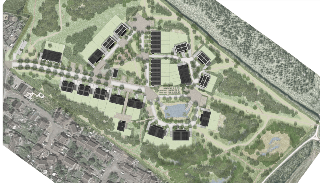
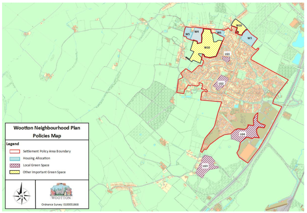
The Plan allocates 4.08 ha of land between Potters Cross and Wootton Road, as shown on the Policies Map (see bottom of page) for housing development for up to 50 dwellings and the provision of open space (3.56 ha).
24/02426/MAF Residential development of up to 50 dwellings, public open space, landscaping, access to Bedford Road, sustainable urban drainage systems and associated infrastructure
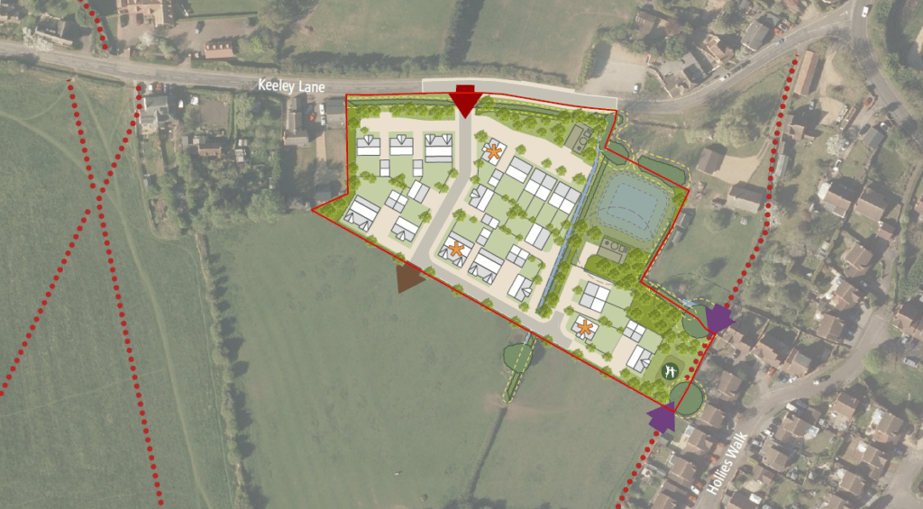
The Plan allocates 3.79 ha of land south of Keeley Lane, as shown on the Policies Map (see bottom of page) for housing development for up to 20 residential dwellings.
23/01846/MAFResidential development of up to 20 dwellings, public open space, landscaping, access to Keeley Lane, sustainable urban drainage systems and associated infrastructure
Site W5
The Plan allocates 1.85 ha of land at Tinkers Corner, Keeley Lane, as shown on the Policies Map (see bottom of page) for housing development for up to 15 residential dwellings.
No plans submitted to date.
Site W6
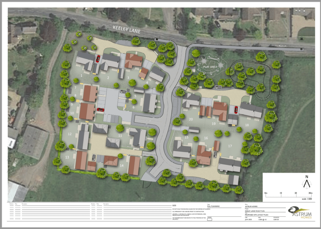
The Plan allocates 1 ha of land south of Keeley Lane, as shown on the Policies Map (see bottom of page) for housing development for up to 20 residential dwellings.
24/01842/M73 Removal of condition 8 and allow for permfitted development rights.
23/02636/MAR Now supersedes the outline application listed below.
22/01035/MAOOutline application with all matters reserved except access, for residential development of up to 20 dwellings, public open space, landscaping, access to Keeley Lane, sustainable urban drainage systems and associated infrastructure |Land On The South Of Keeley Lane Wootton Bedfordshire
23/01578/MARAll Reserved Matters for residential development of up to 20 dwellings, public open space, landscaping, access to Keeley Lane, sustainable urban drainage systems and associated infrastructure, pursuant to Outline permission 22/01035/MAO.